The map is the diagrammatic and symbolic representation of the places of an area of land or sea showing the physical and geographical properties of the places. The use of the map is done to know the exact projection of a piece of land, city, or country. Small to Small measurements can be done easily with the help of a map very precisely and accurately. But my whole life has been a lie about the world map.
The map that I studied and all the children across the nation or globe are studying is wrong. In the world map that we have been studying, countries are shown bigger than the continent but actually, they aren't in real life. Here in the world map below, Greenland seems bigger than South America which isn't true. Russia and Canada are shown very large than their actual size. Africa isn't shown in its proper shape and most other countries haven't their actual shapes and size as per the projection of this map. So, in the real world, the world map shown by computers taught in school, understand by many peoples is a complete lie.

The map that I studied and all the children across the nation or globe are studying is wrong. In the world map that we have been studying, countries are shown bigger than the continent but actually, they aren't in real life. Here in the world map below, Greenland seems bigger than South America which isn't true. Russia and Canada are shown very large than their actual size. Africa isn't shown in its proper shape and most other countries haven't their actual shapes and size as per the projection of this map. So, in the real world, the world map shown by computers taught in school, understand by many peoples is a complete lie.
Figure 1: World Map
But in the middle of the 19th century in the year 1855, James Gall and Arno Peters researched properly on the world map and launched a new map on paper with exact shapes and sizes and projections of the countries and continents, which is called Gall-Peters Projection. In the Gall-Peters Projection of the world map, countries have gained their actual size, Africa has gained its actual shape and size and Greenland doesn't seem bigger than South America. The Gall-Peters projection achieved notoriety in the late 20th century as the centerpiece of controversy about the political implications of map design.
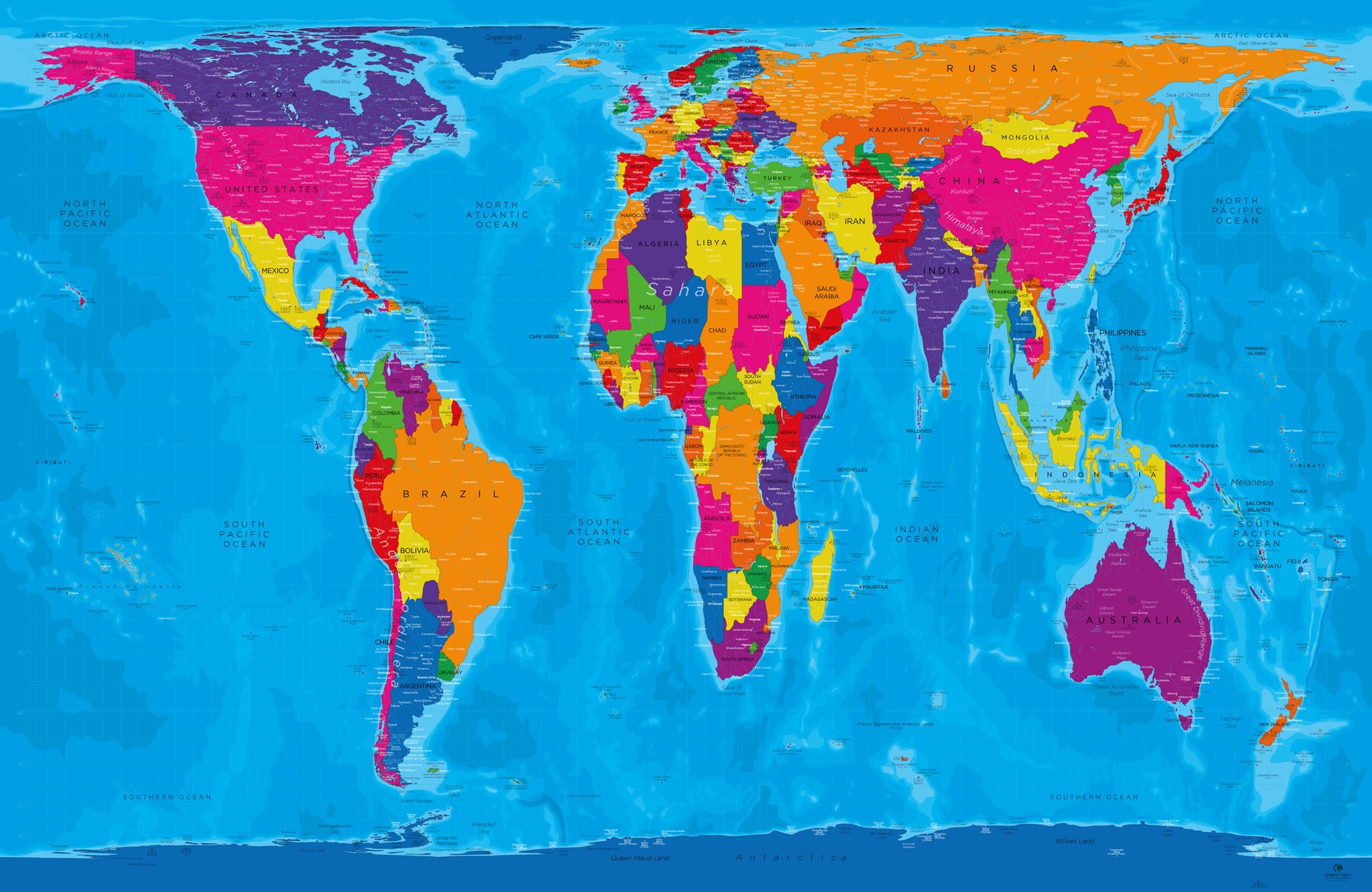
Figure 2: Gall-Peters Projection of World Map
Maps based on the projection are promoted by UNESCO, and they are also widely used by British schools. The U.S. state of Massachusetts and Boston Public Schools began phasing in these maps in March 2017, becoming the first public school district and state in the United States to adopt Gall-Peters maps as their standard.
Since I got to know about Gall-Peters maps I think that the world map is a lie. So, I suggest every country and institution should promote Gall-Peters maps to give the right knowledge and ideas to the children, students, and every citizen of their country.
The earth is flat and there are 9 continents. Antartica is ice wall that avoids the water from falling into outer space.everything is a lie;NASA is a lie, so its not our fault that we got wrong information. The trouble is that these NASA guys are profiting from the fake facts. Next time i want you to to write about why global warming is lie and how wearing face masks can cause respiratory problems.
ReplyDeletehaha
Deleteearth is hollow basically. there are inner earth civilizations flourishing deep in the crust and are many times advanced in technology and we are just their research project on how civilization may destroy themselves.
Delete